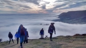
To entice you to get out into this wonderful range of hills, there is no better introduction to the Black Mountains than that provided by Chris Barber, in The Beacon. Extracts are unashamedly reprinted below.

Black Mountains Magic
Chris Barber
(extracts from the article in The Beacon)
The Black Mountains are a range of hills and mountains that largely lie between the towns of Abergavenny, Crickhowell, Talgarth and Hay-on-Wye. And why are they called the Black Mountains? Some say that it was the Saxons who provided the name for they always saw these mountains from the eastern side of the Wye. But when seen from a closer viewpoint the colours may vary from green in summer sunlight, to purple in late summer, changing to russet when the bracken is dying in late Autumn, but brilliant white in Winter, if snow has fallen.
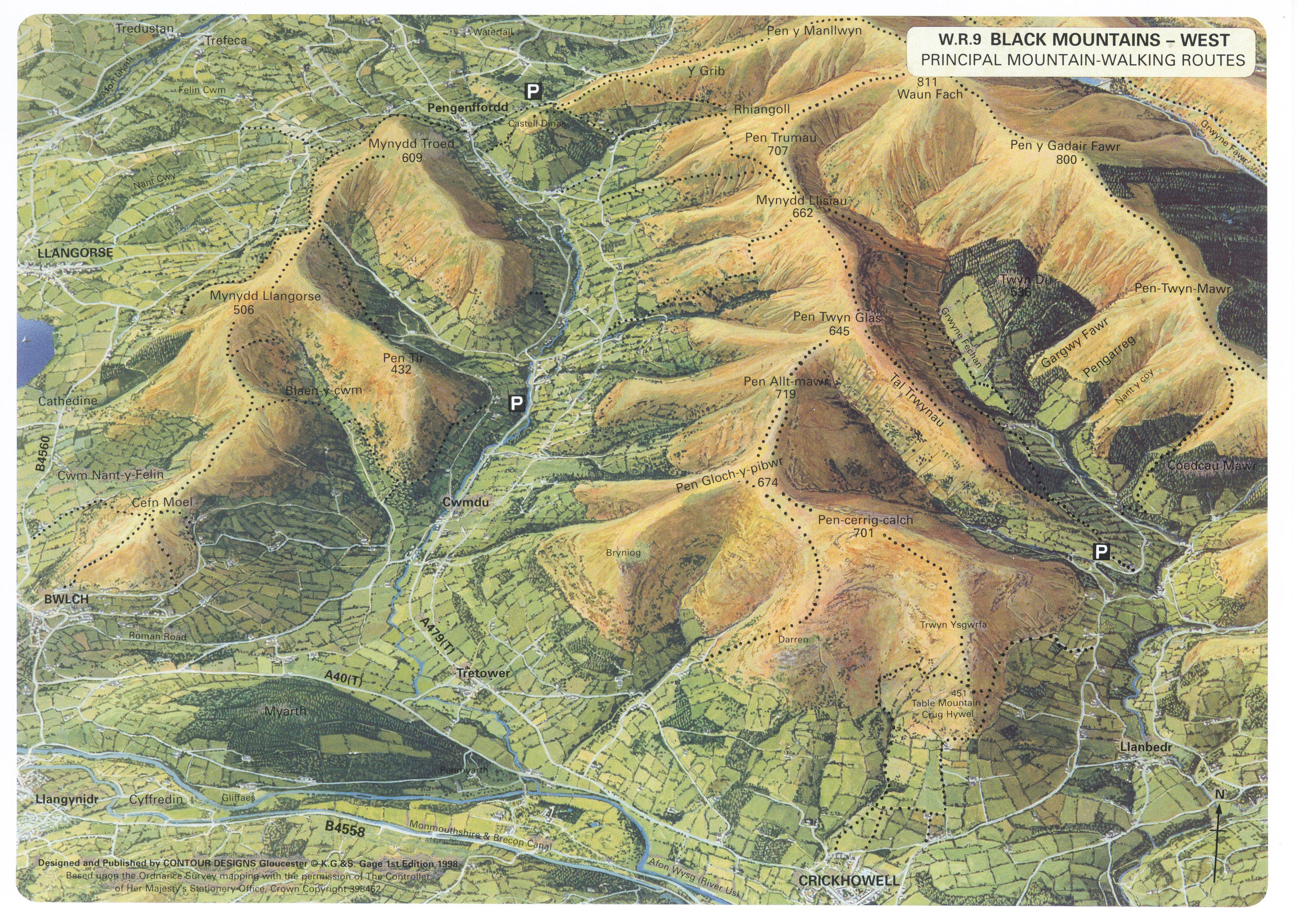
The four main ridges average 17.6 km in length and 600m in height. Waun Fach at 811m is the highest summit, but its neighbour, Pen y Gadair Fawr 800m is a more attractive peak and even looks higher. At the north end of the four main parallel ridges is an abrupt escarpment which overlooks the Wye Valley.
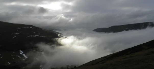
Emerging from the mists of the Olchon Valley
on the Cat’s Back
The best way of remembering the layout of the Black Mountains is to imagine your right hand placed flat on a table with the fingers spread apart. Your thumb is Crib y Garth, or ‘Cat’s Back.
Your first finger is Hatterrall, your second finger is Ffawyddog, with Bal-mawr at the knuckle. Your third finger is the Gader ridge. Your little finger is Allt-mawr and the nail is Crug Hywel, which gives its name to the town of Crickhowel directly below.
On the back of your hand are Y Das, Rhos Dirion, Twmpa and Hay Bluff.

Hay Bluff with the Wye Valley in the distance
The middle of the Hatterrall ridge marks the border of England and Wales and by following it one can walk with one foot in Wales and the other in England. It also provides a high level section of Offa’s Dyke Path, a 268 km National Trail connecting Sedbury, near Chepstow with Prestatyn on the North Wales coast. From this ridge the view east extends to the Shropshire Long Mynd, Clee Hills, Malvern Hills, Graig Syfryddin and the Forest of Dean.
An interesting feature on the Ffwyddog ridge is Dialgarreg, a stone about 1 metre high set into the ground beside the track. Also known as the ‘Stone of Revenge’ it marks the spot where in 1135, Richard de Clare, a Norman knight (brother of the founder of Tintern Abbey) was ambushed and murdered by a band of Welshmen led by Morgan ap Owen.
Further to the north along this ridge is the prominent cairn of Garn Wen. This fine tall, circular cairn has been constructed with the tender care of a craftsman’s skill and it is a useful landmark.
Rhos Dirion on the edge of the north escarpment is marked by a trig’ point (713m), from which impressive views across the Wye Valley may be obtained. Looking west, one may see the Carmarthen Fans while in the near distance stand the Brecon Beacons with the table-top summit of Pen-y-Fan being most distinctive. Looking north one can see a vast expanse of hill country including the heights of Radnor Forest.
One of the finest viewpoints in the Black Mountains is the summit of Pen y Gadair Fawr (Top of the Great Chair), which is marked by a heap of stones (800m), which is perched on a larger Bronze Age cairn.
Pen Twyn Glas (645m) is an interesting summit for it is marked by two upright inscribed stones, which are 19th century boundary markers which bear the names of local landowners – (Mrs Macnamara 1811 and Sir J. Bailey Bart 1847) – whose estates met at this point.

Y Grib (Dragon’s Back)
Pen Cerrig calch (701m) is an interesting summit for it is the only area of Carboniferous limestone in the Black Mountains, and was once part of the Llangattock escarpment, before a glacier carved the Usk Valley.
There are also two minor ridges of special interest which deserve a mention. On the eastern side of the Olchon Valley is the previously mentioned ‘Cats’ Back’ which provides. an exhillarating narrow and rocky ascent to Black Hill. The other distinctive ridge is Y Grib, which is popularly known as the ‘Dragon’s Back’.
It rises from Pengenffordd (above the A479) in a series of humps and is a popular route, via Pen Manllwyn to the summit of Waun Fach.

Iron Age Hill fort – Table Mountain
If you have an interest in archaeology or historic buildings then there are numerous points of interest to include on your walks. Iron Age hill forts such as Crug Hywel (Table Mountain), Castell Dinas or Twyn-y-Gaer make superb viewpoints, while Maen Llwyd, at an altitude of 570 metres on the western slopes of Pen y Gader Fawr is the highest prehistoric standing stone in South Wales. Of interest in the valley below is the remote Grwyne Fawr Reservoir, once the highest in Britain and the story of its construction covers a period of 20 years.
Secluded little churches such as Llanelieu and Partrishow with their amazing rood screens, the famous leaning church of Cwmyoy or the whitewashed chapel at Capely-ffin are gems that can be visited time and time again. There are also the two ruined priories of Craswall and Llanthony, the latter having the added attraction of a vaulted cellar bar, where time seems to have stood still and the real ale makes the perfect ending to your walk.

Maen Llwyd – highest prehistoric standing stone in South Wales
The Black Mountains are a unique range of narrow parallel ridges and attractive valleys and offer the hill walker plenty of scope for circular and linear routes with summits of over 600 metres providing panoramic views.